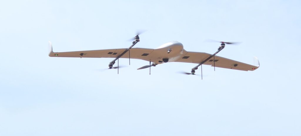

The Indian construction sector is scaling at an unprecedented pace. Infrastructure mega-projects, smart city developments, and commercial real estate expansions require construction management approaches that match this scale and ambition. Traditional site monitoring methods, relying on ground-based inspection and manual data collection, are no longer sufficient. Asteria Aerospace’s drones for construction management and construction monitoring drone solutions give project teams the aerial imagery intelligence platform they need to manage, monitor, and deliver large construction projects more effectively.
Asteria Aerospace is a full-stack drone technology company with over a decade of experience designing, manufacturing, and deploying drone cartography solutions for India’s most demanding operational environments. Its construction drone solutions combine DGCA-certified survey hardware, the SkyDeck cloud data platform, and licensed pilot operations to provide construction companies with a complete aerial monitoring capability.

The Problem With Traditional Construction Site Monitoring
Large construction sites sprawl across hundreds of acres with dozens of concurrent work fronts progressing simultaneously. Ground-based inspection captures only a fraction of site activity, creating blind spots that accumulate into schedule delays and cost overruns.
Scale Exceeds Ground Monitoring Capability
Manual site inspection by engineers and supervisors cannot comprehensively cover large construction sites within the time windows that effective project management requires. Important deviations from plan go undetected until they become expensive problems requiring rework.
Inaccuracy of Manual Volume Measurement
Traditional earthwork volume estimation using manual survey methods introduces significant measurement error that affects contractor payment accuracy, material procurement planning, and cut-and-fill optimization calculations on large earthmoving projects.
Inadequate Documentation for Disputes and Compliance
Construction disputes over progress claims, scope changes, and quality issues are difficult to resolve without comprehensive, objective, time-stamped site documentation. Manual inspection records are insufficient for this purpose compared to drone-captured aerial imagery evidence.
Asteria Aerospace Drones for Construction Management
Asteria Aerospace’s construction drone solutions address the full cycle of construction monitoring needs from pre-construction baseline surveys through ongoing progress monitoring to final as-built documentation.
Pre-Construction Baseline Surveys
Before construction begins, Asteria drones capture comprehensive baseline topographic data including orthomosaics, DTMs, DSMs, and contour maps that establish the reference dataset against which all subsequent progress measurements are compared.
Regular Construction Progress Monitoring
Scheduled drone flights during construction create a time-series dataset that quantifies site development over time. SkyDeck’s comparison tools identify deviations from planned progress, enabling proactive schedule management before delays compound.
Volumetric Earthwork Verification
Asteria’s construction monitoring drone generates accurate cut-and-fill volume calculations by comparing sequential DTM surveys, providing verified earthwork quantities for contractor payment certification and construction material procurement.
Final As-Built Documentation
Post-construction drone surveys create accurate as-built records for regulatory submission, insurance purposes, warranty documentation, and long-term facility management reference in formats that meet professional surveying standards.
Asteria Aerospace Construction Drone Technology
Asteria Aerospace’s construction monitoring drone solutions are built on a technical foundation of in-house manufacturing, proprietary processing software, and regulatory compliance that provides consistent, reliable performance across construction projects of all scales.
-
DGCA-type-certified drones operated by licensed remote pilots ensure full compliance with Indian aviation regulations for all construction site drone operations, meeting client and regulatory requirements.
-
Sub-3 cm per pixel ground sampling distance at 120 meters altitude delivers the measurement accuracy required for professional construction survey, payment certification, and engineering design applications.
-
Coverage of up to 5 square kilometers per flight enables efficient monitoring of large construction sites and infrastructure corridors without multiple time-consuming landing and battery replacement operations.
-
SkyDeck cloud platform delivers processed orthomosaics, DSMs, DTMs, and comparison reports through a web browser, requiring no specialist GIS software or high-performance workstation investment from construction clients.
Proven Results for Construction Clients
Asteria Aerospace has delivered measurable construction project outcomes for leading Indian real estate and infrastructure clients, providing verifiable evidence of the business value that construction monitoring drones deliver.
-
Ambuja Neotia digitized its land development process using Asteria’s full-stack drone solution, generating orthomosaics, DTMs, and DSMs with 2.43 cm accuracy for flood risk modeling and safe construction zone identification.
-
Asteria drone data enabled Ambuja teams to predict waterlogging risk zones using 70-year flood scenario simulations based on Indian Meteorological Department records, informing critical site layout decisions.
-
Construction survey time and cost were significantly reduced compared to traditional ground survey methods, while delivering richer and more comprehensive spatial data products for design and planning.
-
Asteria’s drone intelligence is now deployed across multiple Ambuja Neotia project sites, enabling the company to scale drone-based construction management across its entire development portfolio.
Drone-as-a-Service for Construction Monitoring
Asteria Aerospace offers its construction monitoring drone cartography capabilities under a Drone-as-a-Service model that provides full aerial survey and monitoring capability without requiring construction companies to invest in drone hardware, software, or pilot teams.
-
On-demand drone survey scheduling accommodates construction project timelines, providing monitoring flights at the frequency that project management requires without fixed hardware ownership costs.
-
Pan-India operational capability enables Asteria to serve construction clients across multiple project locations with consistent quality standards and data output specifications.
-
Service agreement models enable construction companies to budget drone monitoring as an operational expense rather than a capital investment, improving financial flexibility for project cost management.
Safety and Compliance in Construction Drone Operations
Construction site environments present specific safety challenges for drone operations. Asteria Aerospace’s operational protocols and DGCA-certified equipment ensure that construction drone deployments are conducted safely and in full compliance with all applicable regulations.
-
Pre-flight site assessment and airspace coordination ensures that construction drone operations do not conflict with other site activities, equipment movements, or nearby infrastructure during survey flights.
-
All Asteria remote pilots hold valid DGCA licenses and follow standardized operating procedures for construction site drone missions, providing clients with professional, insured, and fully compliant aerial imagery survey operations.

Conclusion
Asteria Aerospace’s drones for construction management and construction monitoring drone solutions are giving India’s construction sector a powerful platform for aerial site intelligence. From pre-construction baseline surveys through regular progress monitoring to final as-built documentation, Asteria Aerospace delivers the accuracy, speed, and actionable data that modern construction project management demands. With DGCA-certified hardware, the SkyDeck platform, and a decade of operational experience, Asteria Aerospace is the complete construction drone partner for India’s growing infrastructure and real estate industry.